 The first bridge encountered at Staines when travelling upstream is the railway bridge. This sits on a stretch of track between Egham and Staines stations on the line running from Reading to London Waterloo. This is the same line that crosses the river over Richmond Railway Bridge. Staines Railway Bridge was designed by John Gardner for the Staines, Wokingham and Woking Junction Railway. The SW&WJR was very quickly to become part of the London & South Western Railway. The bridge is built from wrought iron plate girders and rests on two piers consisting of three cast-iron cylinders filled with concrete. The bridge was built by Cochrane & Co and opened for service in 1856. This was the year when the line from Staines was extended out to Ascot and Wokingam. At Wokingham the line then connected with the South Eastern Railway line into Reading.
Saturday, December 30, 2006
Bridges No.38 - Staines Railway Bridge
The first bridge encountered at Staines when travelling upstream is the railway bridge. This sits on a stretch of track between Egham and Staines stations on the line running from Reading to London Waterloo. This is the same line that crosses the river over Richmond Railway Bridge. Staines Railway Bridge was designed by John Gardner for the Staines, Wokingham and Woking Junction Railway. The SW&WJR was very quickly to become part of the London & South Western Railway. The bridge is built from wrought iron plate girders and rests on two piers consisting of three cast-iron cylinders filled with concrete. The bridge was built by Cochrane & Co and opened for service in 1856. This was the year when the line from Staines was extended out to Ascot and Wokingam. At Wokingham the line then connected with the South Eastern Railway line into Reading.
Thursday, December 28, 2006
Bridges No.37 - M3 Motorway Bridge
 The bridge carrying the M3 over the Thames is the first motorway bridge you encounter when travelling upstream, a short distance from Chertsey Bridge and Lock. The M3 bridge is a cantilever bridge and was built in 1971 to a design by Posford, Pavry & Partners with Courtney Theobald acting as consulatant architects. It is built from high tensile steel. Although a single structure with a uniform design, the two carridgeways of the motorway are carried on separate sections and are at slightly different heights. The downstream deck was brought into use first in 1970, with the upstream deck being used from March 1971 when the bridge was completed. However, the bridge forms part of the motorway that was not fully opened until 1974. The original section of the M3 ran from junction 3 (Bagshot) to junction 8 (Michedever). The London bound extension to junction 1 was opened in 1974.
Wednesday, December 27, 2006
Bridges No.36 - Chertsey Bridge
 Given the relatively high population of this part of the country, the stretch of Thames between Kingston and Staines has very few bridges. There is a long stretch from Walton with no road bridge, until the river reaches Chertsey. This bridge at Chertsey is old in comparison to some of the others further downstream. The present day bridge dates from 1785. But the history of a bridge here goes back much further. Henry VI granted the people of Chertsey a licence to build a bridge in 1410. The Abbot of Chertsey saw that the bridge was built and maintained. It was of timber construction and stood about 25 metres downstream of the present day crossing.
Being a wooden bridge it needed regular repairs due to floodwater damage and bridge hits by barges. By 1662 the residents of Chertsey were campaigning for a new bridge, but matters remained unresolved until the late 18th century. In 1779 the bridge was once again in a parlous state. The Justices of Surrey and Middlesex met and obtained estimates for a new stone bridge. James Paine, an architect from Addlestone designed the bridge and work got underway in the early 1780s. The original plan had been for a five arch bridge, but when this was completed there had clearly been an error in the measurements - the bridge didn't reach either bank! Further money had to be spent to build additional spans on both banks, but all was complete by 1785. But the bridge still stands to this day, and remains one of the Thames' oldest and elegant bridges.
Tuesday, December 26, 2006
Bridges No.35 - Walton Bridge

Walton Bridge is not going to win any awards for beauty. This crossing at Walton-on-Thames has a long history, and my thanks go to the excellent resource on the bridge on the Surrey County Council website. There have, to date, been five bridges at Walton, the sixth should be on its way in the not too distant future.
THE 1750 BRIDGE
 The first Walton Bridge was built in 1750 to replace a long standing ferry service. It was funded by a local landowner, Samuel Dicker, MP for Plymouth. Dicker was first and foremost a business man, with plantations in Jamaica, but he was also an MP and he would have travelled through Walton to reach Westminster from his constituency. There was also the businessman's nouse of reaping some tolls from one of the few physical river crossing at the time. Construction work began in 1748 and was built from wood, using an unsual lattice structure. It was designed by William Etheridge. The bridge is most famously captured in a painting of 1754 by Caneletto (shown above) where the design is very striking. To me it looks quite a modern design and reminds me of the Olympic stadium currently being constructed in Beijing.
The bridge, like many of the Thames's early wooden bridge, became expensive to maintain. In 1760 Dicker died and ownership passed to his nephew Michael Dicker Sanders. In 1778 John Smeaton reported on the bridge's condition and recommend it me taken down and replaced by a brick arch. Five years later the bridge was dismantled to make way for the construction of the second bridge.
THE 1788 BRIDGE
 The second bridge followed Smeaton's recommendation for a brick built bridge and James Pain designed it, also making use of stone. Five years passed between the demolition of the first bridge and the completion of Pain's structure. The bridge stood for 73 years until disaster struck in August 1859. The twon central arches collapsed suddenly into the river. The theory was that settlement of the foundations under the central pier led to the collapse. There was an urgent need for the bridge to be replaced and until that could happen ferries returned to ply their trade at Walton.
THE 1864 BRIDGE
 Following the collapse the then owner, Thomas Newman Allen, promoted a Parliamentary Bill for a new bridge at Walton, together with two further bridges downstream to fill the gap between Walton and Hampton Court. These two bridges never became a reality, but Walton Bridge was rebuilt and opened in 1864. The bridge was of iron girder construction resting on brick and stone piers. It was designed by E T Murray. On the Walton side of the river a brick arch viaduct was also built acorss the area of floodplain. This section of the bridge remains to this day. Tolls were removed in 1870 when ownership of Kingston and Walton bridges passed to the Metropolitan Board of Works.
In 1940 the bridge was damaged during a German air raid. The structure was weakened as a result and weight limits were imposed. After the war, and the construction of the fourth bridge, the third bridge remained in use for pedestrians and cyclists but by the 1980s it became to costly to maintain it and it was demolished in 1985.
THE 1953 BRIDGE
With the 1864 bridge become ever more weaker following the war, Middlesex County Council built a bridge immediatley alongside it in 1953. It was intended to be built quickly and to act as a temporary crossing before a more permanent solution was found. The bridge was known as the 'Callender-Hamilton' bridge. However, the bridge still stands to this day on the downstream side of the crossing and is the section shown in my main picture at the top of this entry.
Given the temporary nature of the bridge it was never designed to require long-term maintenance. For instance the metal work on the bridge was never painted, and no waterproofing was provided between the roadway and the steel supporting plates. When the third bridge was demomlished in 1985 the fourth bridge also underwent a thorough inspection and a weight limited was imposed. The plan was to allow continued use of the bridge, with maintenance work as required, until such a time as permanent replacement could be constructed. However, by 1993 this had still not happened, and further assessments of the bridge's structure led to a further reduction of the weight limit.
In June 1998 the then six-monthly safety inspections showed the need for more strengthening works, but once again the weight limit had to be reduced, down to 7.5 tonnes. The fourth bridge remains in place today, but like the third bridge before it, it is now only used by pedestrians and cyclists.
THE 1999 BRIDGE
The 1998 inspection of the fourth bridge led to the urgent requirement for a new bridge for road traffic. That inspection determined that it would now be too costly to continue to maintain the fourth bridge. The fifth bridge was built in the same position as the third, alongside the 1953 bridge. The 1999 bridge is was built very quickly. An application to Government for funding for a temporary crossing was submitted in August 1998. Planning permission was granted in June 1999 and construction began in August. By December the bridge was complete.
THE 2009 BRIDGE?

A condition of the planning permission for the 1999 bridge was that bridge would only be in place for a maximum of 10 years. Therefore a brand new bridge is required for February 2009, although that deadline is looking increasingly ambitious. In 2003 different design options were made available for public consulatation. The Tiered Arch design, shown above, was subsequently selected in Sepetember 2003. The scheme also includes some improvements to the road layout in the immediate area of the bridge. For this a compulsory purchase order in required, but in December 2006 the Department of Transport decided not to confirm the CPOs drafted by Surrey County Council. Consequently the scheme is on hold until the issues are resolved, and it is now highly unlikely that a new bridge will be in place by 2009 and some maintenance work will be needed on the current crossing.
Thursday, December 21, 2006
Bridges No.34 - Hampton Court Bridge

Hampton Court Bridge, like the nearby Palace and the area around it, has a long history. The first bridge was built here in 1752/53 at a point where an older ferry crossing was in existence. The bridge was wooden in construction and comprised of seven arches in the Chinoisere style. This is essentialy a Western European design style that influenced heavily by traditional Chinese design. The bridge adopted a style similar to the Willow Pattern seen on blue plates. The the bridge only lasted 25 years before being replaced by a second wooden bridge in 1778, which was a little more robust.
Almost 100 years later, in 1864, work began to replace the bridge once more, this time to a design by E T Murray. The new bridge was built from wrought iron lattice girders resting of four cast iron columns. The approach the the bridge was by way of crenallated brick walls, the remains of one still standing today on the south bank. The bridge opened in 1866.
The present day bridge is the fourth for Hampton Court and was designed by W P Robinson and Sir Edward Lutyens. The new design was created to complement the proportions of the nearby Palace. Work began in 1930 and the bridge is constructed from reinforced concrete with a facing of red bricks. The bridge opened in July 1933, on the same day as both Chiswick and Twickenham Bridges.
Sunday, December 03, 2006
The Walk - A Summary So Far
Now that I've done 10 days of the walk I thought I'd tally up how far I've walked so far. I started over the Easter weekend, which now seems a long time ago. But most weekends I've been busy with other things, that have meant I've not been able to do the walk. The journey breaks down as follows:
Day 1 Crayford Ness - Charlton 10.5 miles
Saturday, December 02, 2006
Day 10: Maidenhead - Marlow
I’ve often started these accounts of the daily walks with an account of the weather, and today was a mild day (for December) with some pleasant sunny spells. And the warmer temperatures that we seem to have had this year have led us to have a particularly wet autumn. Since I arrived at Maidenhead at the end of October, a lot of water has passed under the bridge, and on arriving at Maidenhead Bridge this morning, there was still a lot of water passing underneath it. The river was high, as I’d suspected, but the Environment Agency website said that there was no flood warning for this stretch of the Thames, so all should be well for a walk to Marlow. But the river was definitely higher, flowing faster, and browner – a sign of more silt and mud being carried.
 The path from Maidenhead follows the road north to Cookham as far as Boulter’s Lock. This entrance to the lock is marked by a small hump-backed bridge, and it was a surpise to see the lock immediately behind it. Since I last went walking the river has closed up for the winter. Many of the locks are now shut, some are being refurbished and the cruisers are tied up in the marinas. After Boulters, the path moves off road once more, passing some large houses once more, including Maidenhead Court. Oddly, these big piles are larger than the houses south of Maidenhead, but they don’t look as grand. Many seem to have been converted into flats and retirement homes with the odd harsh warning sign to deter trespassers – one giving details of laser powered concealed CCTV.
 Soon there are just fields and trees all around and the path starts to get a bit muddy. To the right, on the opposite bank, the high escarpment of the Cliveden Estate is showing off the last of its autumn colour. If I’d been down here a couple of weeks ago I suspect it’d have been a riot of oranges, browns and red, but by now most of the leaves had dropped. Sadly you don’t get a view of Cliveden itself, but you do see the manicured lawns and chocolate box cottages on the bankside, and a round tower folly high up on the hill.
 At this point, where there used to be a ferry for the horse drawn boats, the path turns away from the river, down pathways and lanes towards Cookham village. Cookham is a typical English village with a scienic view down the high street. Around the corner and the path passes through churchyard of Holy Trinity Church, a beautiful 12th century church with square tower. This leads straight down to the river, just upstream of Cookham Bridge. The riverside path passes through Cookham Reach Boat Sailing Club and then onto the open marsh land.

 Through a gate and we’re onto National Trust land, signed as Cock Marsh. This leads the path up to the Bourne End Railway Bridge where the path passes across the footbridge towards Bourne End village. Turn left and down a narrow path way to the riverside boathouses. The river now turns westwards and once past the long run of these boathouses the path comes to the edge of Spade Oak Meadows. Here the train line from Marlow comes very close to the river and very close to the path. Here the trains run very slowly – perhaps because of the waterlogging.
 I assume that the river did flood over here earlier in the week, as the meadows, particularly the first field, are very very muddy (I should have worn my walking boots!). The sun was getting low now and reflecting off the river as we approached the large villas on the opposite bank, some clinging to the slopes of Winter Hill. Some are particularly stunning (but the best are hidden on the other side of the island – having sailed down this stretch in the summer I can vouch for that). Then the path curves round and heads towards Marlow. Under the by-pass bridge and into a park the path moves away. Here its worth just nipping down a side path to see a stunning view of Marlow from Marlow Lock. Historically the horse drawn barges had to untie their horses along this stretch and the horses were led around Marlow streets and the Seven Corner Alley, a narrow high-walled path around the backs of Marlow’s buildings. Emerging from the alley I drew my walk to an end and headed for the station.

 The path from Maidenhead follows the road north to Cookham as far as Boulter’s Lock. This entrance to the lock is marked by a small hump-backed bridge, and it was a surpise to see the lock immediately behind it. Since I last went walking the river has closed up for the winter. Many of the locks are now shut, some are being refurbished and the cruisers are tied up in the marinas. After Boulters, the path moves off road once more, passing some large houses once more, including Maidenhead Court. Oddly, these big piles are larger than the houses south of Maidenhead, but they don’t look as grand. Many seem to have been converted into flats and retirement homes with the odd harsh warning sign to deter trespassers – one giving details of laser powered concealed CCTV.
 Soon there are just fields and trees all around and the path starts to get a bit muddy. To the right, on the opposite bank, the high escarpment of the Cliveden Estate is showing off the last of its autumn colour. If I’d been down here a couple of weeks ago I suspect it’d have been a riot of oranges, browns and red, but by now most of the leaves had dropped. Sadly you don’t get a view of Cliveden itself, but you do see the manicured lawns and chocolate box cottages on the bankside, and a round tower folly high up on the hill.
 At this point, where there used to be a ferry for the horse drawn boats, the path turns away from the river, down pathways and lanes towards Cookham village. Cookham is a typical English village with a scienic view down the high street. Around the corner and the path passes through churchyard of Holy Trinity Church, a beautiful 12th century church with square tower. This leads straight down to the river, just upstream of Cookham Bridge. The riverside path passes through Cookham Reach Boat Sailing Club and then onto the open marsh land.
 Through a gate and we’re onto National Trust land, signed as Cock Marsh. This leads the path up to the Bourne End Railway Bridge where the path passes across the footbridge towards Bourne End village. Turn left and down a narrow path way to the riverside boathouses. The river now turns westwards and once past the long run of these boathouses the path comes to the edge of Spade Oak Meadows. Here the train line from Marlow comes very close to the river and very close to the path. Here the trains run very slowly – perhaps because of the waterlogging.
 I assume that the river did flood over here earlier in the week, as the meadows, particularly the first field, are very very muddy (I should have worn my walking boots!). The sun was getting low now and reflecting off the river as we approached the large villas on the opposite bank, some clinging to the slopes of Winter Hill. Some are particularly stunning (but the best are hidden on the other side of the island – having sailed down this stretch in the summer I can vouch for that). Then the path curves round and heads towards Marlow. Under the by-pass bridge and into a park the path moves away. Here its worth just nipping down a side path to see a stunning view of Marlow from Marlow Lock. Historically the horse drawn barges had to untie their horses along this stretch and the horses were led around Marlow streets and the Seven Corner Alley, a narrow high-walled path around the backs of Marlow’s buildings. Emerging from the alley I drew my walk to an end and headed for the station.
Saturday, November 11, 2006
Bridges No.33 - Kingston Bridge
 It is hard to imagine in 2006 that for hundreds of years the only way of crossing the Thames was by boat. Kingston Bridge was the only bridge crossing of the Thames upstream of London Bridge. This status ended in 1729 with a wooden bridge at Putney, but bridges at Kingston (mainly wooden) had been in existence since the 13th century and assisted in the growth of Kingston as a settlement.
Little seems to be known about the early wooden bridges, but there are known to have been at least three. The last timber bridge was in a poor state of repair when it finally was replace and at only 12 feet wide was increasingly incapable of handling traffic volumes. The first masonry bridge was completed in 1828. This bridge had five arches built from Portland stone to a design of a Edward Lapidge. The first stone was laid by the Robert Jenkinson, the 2nd Earl of Liverpool in November 1825. In 1870 the bridge became toll-free, the first time this situation had prevailed for over 650 years. It was a cause of local celebration with a firework display and the toll gates were ceremoniously burnt in on Hampton Green.
Tram lines were added in 1907, but the narrow width of the bridge was once again creating difficulties. Tragically a young cyclist was killed on the bridge in 1911 and led to the widening of the bridge. It was extended by 55 feet on the downstread side by Mott & Hay and reopened in 1914 with a new facing of Portland stone that was designed to replicate the original 1828 facade. More recently the bridge was widened for a second time in 2000, this time on the upstream side, allowing for bicycle lanes, winder footpaths and a bus lane to be included. It reopened a year later.
Friday, November 10, 2006
Bridges No.32 - Kingston Railway Bridge
 Kingston Railway Bridge won't win any awards for its looks looking dull even on a bright sunny day. The Thames Path passes along a service road under one of the main spans, which is also shared by a car park. The bridge is used by South West Train services on the 'Kingston Loop' leading trains towards Shepperton and Richmond. It forms part of the line bewteen Kingston and Hampton Wick stations. The bridge is gunmetal grey and is now bedecked by pipes transporting some unknown commodity over the Thames.
The bridge was built by the London & South Western Railway and was designed by J E Errington, however, he died just before work on the bridge commenced. W R Galbraith took Errington's place to oversea the construction of the bridge. It was built by Thomas Brassey and opened in July 1863.
Thursday, November 02, 2006
Westminster Bridge - An Update
Back in July I added my entry for Westminster Bridge and noted that there appeared to be some repair work going on. This week there was something of an explanation from Transport for London. TfL are currently replacing the cast iron fascias on the bridge. There are 14 in total, and so far two have been replaced. Each fascia weighs 15 tonnes and was lifted into place by a floating crane. My picture from the summer clearly shows the crane in position. Work on the third fascia begins this November. This work forms part of a longer term maintenance job on the bridge. In 2005 scour protection works were carried out. The fascia replacement, currently underway, should be completed by late 2007. In 2008 the lighting on the bridge is due to be renewed, as is the road surface. Finally corrosion protection work will be carried out, with all works due to finish in 2009.
More info on the TfL website.
More info on the TfL website.
Sunday, October 29, 2006
Day 9: Datchet - Maidenhead
 I’m struggling to find weekends when I can do some of the walk now. Either I’m busy with other things, or like last weekend the weather was lousy. Luckily we had a bright sunny day, and like much of this autumn it was unusually warm from the time of year. It was also the day the clocks went back – winter will be here soon!
So to Datchet, and a short walk from the station to the river – just what I like. However, the walk starts along the main road through the village, until eventually a small path turns back to the river. There is then a pleasant stroll through the riverside woods with the first glimpse of Windsor Castle. Very soon I’m at the Victoria Bridge, the companion bridge to the Albert Bridge further downstream. The path cross back over the river at this point onto The Home Park. Here there are great views of both the Castle and Eton College chapel. And on this Sunday morning the park is packed with schoolboy rugby – so this could well be the ‘playing fields of Eton’. The path then passes under the railway and through a boatyard. Windsor Lock is nearby, but we don’t go anywhere near. Then very quickly I’m in Windsor itself. At this point the path cross the river again over the pedestrian only Windsor Bridge across to the southern end of Eton High Street.
 The path then goes past the old Eton Boat House and onto the meadows with the classic river view of the Castle. Up ahead I quickly catch up with a ‘crocodile’ of OAPs on a morning stroll. Eventually I get past them at one of the bridges that pass over the river just west of Windsor. On the southern bank the eastern edge of Windsor Race Course can be seen while the river kinks quiet sharply. I follow the river but the OAPs take the short cut. By the time I rejoin the main path, they’ve overtaken me and I have to go through the same delicate process of trying to get past them!
 The path no edges fields until it reaches Boveney Lock and goes on to the small, wooden built chapel dedicated to St Mary Magdalene. The chapel was once in a quiet spot by Boveney Court alongside the vast expanse of Dorney Fields. However, now there is a bit more going on here. Particularly today. Ahead is Dorney Lake, Eton College’s purpose built rowing lake construction of which began in 1996 and took 10 years to fully develop. It was used earlier this year for the World Rowing Championships and will be the rowing venue for the 2012 Olympics. The facility opened in 2000, and today was playing host to a 10,000 km race for Cancer Research UK.
 The rowing lake run diagonally away from the river and eventually it is in the distance, while the riverside path winds it way through riparian woodland. Eventually the gothic splendour of Oakley Court appears on the opposite side of the river. Oakley is now a hotel was originally built as a private house in 1859 for Sir Richard Hall Say. In 1965 the then owner died and the property stood empty for 14 years, but with Bray Studios next door, it was used as a setting in a number of films in particular the St Trinians series, The Rocky Horror Show, Half A Sixpence, Murder by Death and a number of Hammer House Horror films including Dracula.
 Soon I am at Bray Lock, a very small lock that is about to go through some refurbishment and bank strengthening work over the winter. The M4 bridge is then close by and the rest of the walk involves more woodland paths up to the large riverside houses at Taplow and Maidenhead, leading to Brunel’s impressive bridge for the Great Western line. Unlike at Datchet, I then have a walk of just over a mile to Maidenhead station. Bad news!
Saturday, October 28, 2006
Bridges No.31 - Teddington Footbridge
 The Teddington Lock Footbridge crosses a particularly wide part of the river at the point where the tidal influences on the river cease. There are two parts of the bridge, the bit I took a picture of the suspension bridge, being the most interesting and largest - it links Teddington to the lock island. Another iron girder bridge crosses the channel of the lock system from the island to Ham.
Until Teddington Lock was built, the river was tidal as far as Kingston. Construction began in 1810 and was completed with the weir in 1812. The first lock was entirely built from timber and had to be repaired in 1825. A major rebuild took place in 1856-8 when foundation stones were laid and a narrow skiff lock was included. In 1869 a boat slide was added and in 1904-5 a large the barge lock was built. This is now the largest lock along the whole length of the Thames.
The two bridge were put in place between 1887 and 1889. The bridges were designed by G Pooley and replaced a ferry at Teddington.
Thursday, October 26, 2006
Bridges No.30 - Richmond Bridge
 Richmond has the honour of being the oldest surviving bridge in Greater London. It was built in 1777 and replaced a long-lasting ferry service. The ferry operator, William Windham, petitioned parliament for a Bill permitting a bridge to be built at Richmond. However, there was considerable resistance from the local residents. They did not like the idea of a wooden bridge, the traditional construction material for bridges at the time, being built in Richmond. There was also opposition towards a toll bridge. However, stone was considered a more acceptable building material and this was ultimatley chosen.
The architects of the bridge were James Paine and Kenton Couse, and it was constructed between 1774 and 1777. Despite the opposition to tolls, this was the usually arrangement for bridges at the time, prior to ownership by local authorities. At Richmond there were gates at either end of the bridge, with small lodges for the toll-collectors.
Ownership of the bridge passed to the counties of Surrey and Middlesex in 1927, the 150th anniversary of opening of the bridge. Ten years later the bridge was widen on the upstream side.
Saturday, September 23, 2006
Day 8: Staines - Datchet
A surprisingly warm and sunny day for late September for the next stage towards Windsor. Staines has been an unusual town compared to the other I’ve passed through so far in that it has pretty much turned it’s back on the river. There is very little going on along the Staines river frontage. A new winding path, decking and awnings have been put in place over recent years (probably a Millennium project). There is the obligatory piece of public art, one of which I quite liked. It was a sculpture, in a very shiny metal, of two origami swans. Indeed having looked on the web now I see that this area goes by the name of the Artwalk.
 After this short walk the path crosses Staines Bridge, and continues along the river next to office buildings and industrial sites. Shortly two features, one old and one new, mark the last influences of London. The first is another City of London coalpost, this time a white painted iron post. This will be the last I pass on the Thames. Close by is what many would now regard as the edge of London – the M25. The extra wide motorway is carried over the river on two bridges, but the path continues under and runs past a groups of houses and the grounds of Bell Weir Lock. Soon the houses give way to open ground, a park area and the start of Runnymede Meadows. Once round this kink in the river we are onto the Meadows proper (albeit between road and river), on National Trust land. The Meadows themselves are famous as the camping grounds of King John and his army, when in 1215 John signed and sealed the Magna Carta on the island across the river. There are many notable buildings and monuments that
  have been erected here, all in the last 100 years. The first is high up on the wooded ridge to the west. This is the Commonwealth Air Forces Memorial built in 1952 in memory of the airmen from across the Commonwealth who lost their lives during the Second World War. The names of the missing airmen are carved into the walls around a cloister and the tower has views across seven counties.
 A short walk further on and there is a good view from the path of the Magna Carta Memorial. This was built in 1957 to a design by Sir Edward Maufe. It was built by the American Bar Association and consists of a domed roof resting on classical columns. One of the pillars is carved from English granite and carries the inscription “TO COMMEMORATE MAGNA CARTA, SYMBOL OF FREEDOM UNDER THE LAW”.
Nearby, but not visible from the path is another monument in memory of John F Kennedy. In December 1963 the British Government gave an acre of land, where the monument now sits, to the United States in memory of their assassinated President. Given all the relevance of Runnymede and its importance in the formation of modern democracy, this just seems like another stretch of the Thames.
 Up ahead are two gatehouses leading at the edge of Runnymede Meadows. They were designed by Edward Lutyens on commission from the Lady Fairhaven in memory or her husband Urban Hanlow Broughton, Lord Fairhaven, the then landowner of Runnymede. One now houses a National Trust tearoom making a great stop of point for a break.
The path then comes very close to the main road and a roundabout. The sign ahead says Old Windsor and marks our passing from Surrey into Berkshire. Having passed a Harvester it’s back to a stretch of river with very large houses with very large gardens running down to the river, all of them looking very desirable! One house even has a pet owl called Dobby. On the edge of Old Windsor a side path leads round to the delightful Old Windsor Parish Church.
Back along the riverside and we arrive at Old Windsor Lock. Here the path deviates away from the main river channel and follows a special cut. Indeed even the boats are directed up the cut, quite a narrow straight channel up towards Albert Bridge. At the end of the cut, the path enters the most rural area yet with no buildings visible on either bank. But around the corner is Albert Bridge where we cross the river. The reason for this is that we are now alongside Windsor Great Park and the area ahead is closed for security reasons. It runs close to Frogmore House, and later Windsor Castle itself. But for now the path leads along a short river path before heading away from the river, down the side of a field and back to the road to the edge of Datchet. This whole stretch of the walk is dominated by the Heathrow flight path with a plane passing very close overhead every few minutes.
 Once into Datchet I come to a stop when the road meets the river once more. This is the point of the old Datchet Bridge, now no longer there. I’ll explain more when I get to tell you about Albert Bridge, but for now it a short stroll up High Street and Datchet Station.
 After this short walk the path crosses Staines Bridge, and continues along the river next to office buildings and industrial sites. Shortly two features, one old and one new, mark the last influences of London. The first is another City of London coalpost, this time a white painted iron post. This will be the last I pass on the Thames. Close by is what many would now regard as the edge of London – the M25. The extra wide motorway is carried over the river on two bridges, but the path continues under and runs past a groups of houses and the grounds of Bell Weir Lock. Soon the houses give way to open ground, a park area and the start of Runnymede Meadows. Once round this kink in the river we are onto the Meadows proper (albeit between road and river), on National Trust land. The Meadows themselves are famous as the camping grounds of King John and his army, when in 1215 John signed and sealed the Magna Carta on the island across the river. There are many notable buildings and monuments that
  have been erected here, all in the last 100 years. The first is high up on the wooded ridge to the west. This is the Commonwealth Air Forces Memorial built in 1952 in memory of the airmen from across the Commonwealth who lost their lives during the Second World War. The names of the missing airmen are carved into the walls around a cloister and the tower has views across seven counties.
 A short walk further on and there is a good view from the path of the Magna Carta Memorial. This was built in 1957 to a design by Sir Edward Maufe. It was built by the American Bar Association and consists of a domed roof resting on classical columns. One of the pillars is carved from English granite and carries the inscription “TO COMMEMORATE MAGNA CARTA, SYMBOL OF FREEDOM UNDER THE LAW”.
Nearby, but not visible from the path is another monument in memory of John F Kennedy. In December 1963 the British Government gave an acre of land, where the monument now sits, to the United States in memory of their assassinated President. Given all the relevance of Runnymede and its importance in the formation of modern democracy, this just seems like another stretch of the Thames.
 Up ahead are two gatehouses leading at the edge of Runnymede Meadows. They were designed by Edward Lutyens on commission from the Lady Fairhaven in memory or her husband Urban Hanlow Broughton, Lord Fairhaven, the then landowner of Runnymede. One now houses a National Trust tearoom making a great stop of point for a break.
The path then comes very close to the main road and a roundabout. The sign ahead says Old Windsor and marks our passing from Surrey into Berkshire. Having passed a Harvester it’s back to a stretch of river
 with very large houses with very large gardens running down to the river, all of them looking very desirable! One house even has a pet owl called Dobby. On the edge of Old Windsor a side path leads round to the delightful Old Windsor Parish Church.
Back along the riverside and we arrive at Old Windsor Lock. Here the path deviates away from the main river channel and follows a special cut. Indeed even the boats are directed up the cut, quite a narrow straight channel up towards Albert Bridge. At the end of the cut, the path enters the most rural area yet with no buildings visible on either bank. But around the corner is Albert Bridge where we cross the river. The reason for this is that we are now alongside Windsor Great Park and the area ahead is closed for security reasons. It runs close to Frogmore House, and later Windsor Castle itself. But for now the path leads along a short river path before heading away from the river, down the side of a field and back to the road to the edge of Datchet. This whole stretch of the walk is dominated by the Heathrow flight path with a plane passing very close overhead every few minutes.
 Once into Datchet I come to a stop when the road meets the river once more. This is the point of the old Datchet Bridge, now no longer there. I’ll explain more when I get to tell you about Albert Bridge, but for now it a short stroll up High Street and Datchet Station.
Friday, September 22, 2006
Bridges No.29 - Richmond Railway Bridge
 Richmond Railway Bridge today carries trains on the South West Trains network out towards Reading and Windsor. It is on a stretch of track between Richmond and St Margaret's stations. The line from Richmond to Waterloo, via Clapham Junction opened in 1846, but the ambition has always been to run passenger services from Waterloo, direct to Royal Windsor. A year after the Richmond line opened, and Act was passed permitting the extension of the line to Windsor via Staines. The Windsor, Staines and South-Western Railway Company had the honour to go ahead and build the line.
To get to Staines and Windsor the bridge had to cross the river, and a new railway bridge was designed for this purpose by Joseph Locke. The bridge was constructed from cast iron and consisted of three 100 foot spans formed of six iron ribs bolted together. On the Richmond side of the river, a brick viaduct were built to carry the line across the sloping ground of the Old Deer Park.
The line opened in 1848 and Locke's bridge continued in service for 60 years. In 1891 a cast iron railway bridge at Norbury Junction, near Croydon, collapsed. The design was similar to Richmond Bridge and concerns arose regarding the safety of the bridge. By 1906 the railway company instructed the Horseley Bridge Company to replace Locke's bridge. The new bridge was designed by J.W. Jacomb-Hood, the chief engineer at the London & South Western Railway.
The bridge was complete in 1908 and is still in use today. Like other railway bridge, it is effectively more than one bridge, with each line being supported on a separate crossing. The only significant work on the bridge was in 1984 when the main girders and decking were replaced.
Thursday, September 21, 2006
Bridges No.28 - Twickenham Bridge
 Twickenham Bridge has already had a mention here in the entry for Chiswick Bridge. Both were part of road improvements in the 1930s when the Great Chertsey Road was constructed. Twickenham Bridge was designed by Maxwell Ayrton, but follows the design of Sir Herbert Baker's Chiswick Bridge. It has constructed from reinforced concrete with bronze ballustrades and lamps. Unlike Chiswick, Twickenham Bridge is has not been finished with Portland stone. However, Twickenham has an extra feature not found on Chiswick - namely hinged sections at to allow for the bridge absorb vibrations and movements. The bridge opened in July 1933 on the same day as both Chiswick and Hampton Court Bridges. There was some local resistance the the construction of the bridge in the 1920s and 30s, as it did have to pass through park of Richmond Old Deer Park.
Saturday, September 16, 2006
Day 7: Shepperton - Staines
 A shorter leg to walk today, but the weather is nowhere near as good as it on previous legs. Its overcast, but reasonably warm. However, as has been the case through most of September, it was muggy. I drove to Staines and caught the bus to Shepperton, which was a lot more alive on a Saturday than a few weeks ago on a Sunday.
At the end of Ferry Lane, where I’d previously caught the ferry to, I finally returned to the Thames Path. Much of the walk to Staines involves a walk very close to the river bank. However, there’s also a road right alongside, and this begins here at Shepperton Lock. A very English setting around the lock was taking place this morning with a fete of sorts in aid of the RNLI. As I passed a couple were setting up the stall for the Surrey branch of the International Guild of Knot Tyers, ironically having great difficulty knotting their banner to their tent. This, though, was to be the most exciting bit of this walk.
 Sadly, there was little of consequence to see along this stretch of the river. That’s not to say it isn’t picturesque, but there are long stretch’s alongside roads and then even longer stretches alongside people’s houses. After a few sharp turns in the river upstream of Shepperton the small road from the ferry finally leaves the river and we are onto a dirt track. This must be the first ‘natural’ footpath I’ve been on so far in the walk and shows that London is now being left behind. There are some large houses and gardens here, including one with a boat house with direct access to the river. Normally the footpath would divert around it, but in this case it goes up and over the roof.
 The path soon starts to weave around a little as it passes a small collection of house boats. The residents here clearly do not welcome the cyclists who tear along other stretches of the Thames Path, as there are lots of home made no cycling signs attached to almost every tree.
As Chertsey nears the path enters Dumsey Meadows. My book tells me this river meadow is the last before London, so yet another sign of the rural feel of the walk. However, Dumsey Meadows are quite compact, and very soon I’m passing under Chertsey Bridge and back to another path between road and river. And I am alongside this road all the way to the village of Laleham with the only significant features being Chertsey Lock and the M3!
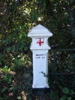
 At Laleham the road leaves the river allowing the riverside houses of the village to overlook the Thames. Around the next corner is Penton Hook, a very tight meander in the river whose neck was flooded on so many occasions in the 19th century that barges used it as a short-cut. So popular did it become that a full channel was cut across the neck and a weir and lock system built. Penton Hook Lock was also the further upstream lock built by the Corporation of London, and like at other locks this is clear with the City’s crest present of the gable end of the lockkeeper’s cottage.
We are now on the edge of Staines, and the river path now just passes the many varied houses. Across the river I spy a post with a red cross on it. Could this be another City of London coal post? I’ll need to check, but I get a snap of it on maximum zoom.
 Approaching Staines the shopping centre and BUPA offices dominate the skyline. But it was a real surprise to see St Peter’s Church right alongside the river. A wedding was just getting underway as I passed.
Friday, September 08, 2006
Bridges No.27 - Richmond Lock
 Next up is a rather curious structure that looks like a bridge, and doubles as a bridge but has another identity - a tidal barrier.
The river, even at Richmond is still tidal in nature although we are now very close to Teddington where all marine influence ends. Until 1832 the Old London Bridge (the one with all the houses built on it) had almost acted as a full barrier across the Thames and had reduced the tidal effects further upstream. When it was demolished there were unexpected consequences further upstream. Some bridges suffered from increased erosion at the base of their piers and ultimately had to be replaced with the faster moving tides. At the same time dredging activity increased in the lower reaches of the river. At Richmond the size of the river shrunk significantly to the extent that on some occassion it was little more than a stream running through mudbanks. The river can still get quite narrow - just look at my picture of Barnes Bridge at low tide to see.
In 1890 premission was given for the construction of a half-lock and weir just downstream of Richmond. A barge lock was built against the Surrey bank joined by a weir and three sluice gates. To operate the sluices a superstructure was required and it was decided that this should take the form of a footbridge. For two hours during high tide the sluices are raised into the footbridge structure and boats can pass through as if this were a normal bridge. For the rest of the tidal cycle the sluices are moved down and closed. Boats must then use the lock system. This results in maintaining water levels between Richmond and Teddington locks.
Thursday, September 07, 2006
Bridges No.26 - Kew Bridge
 Kew Bridge has a lot of history tied up in it reflecting the changing nature of business, the nobility and royalty in this part of West London. Kew has also been a popular crossing point through history. There have been three bridges here and prior to all of them a horse-drawn ferry. It was the Tunstall family, led by Robert Tunstall, who owned and operated the ferry service, that petitioned Parliament for permission to build a bridge at Kew. Work began on the first bridge in 1758 by John Barnard who had previously worked on Westminster Bridge. It was inaugurated on 1 June 1759 by George, the Prince of Wales. It was George's father Frederick who took a lease at Kew House in 1731 and rebuilt it. This is now Kew Place, and the Royal Botantic Gardens grew up around it.
Like other private bridges of the time, Kew Bridge charged a toll. The opening of the bridge, and its connections with the Prince of Wales resulted in much excitement. 3,000 people used the bridge on its first day open to the general public. Even so, new London bridges still attract the crowds as we saw with the Millennium Bridge. Barnard's bridge consisted of two stone arches next to each bank connected together by 7 timber arches. But because the bulk of the bridge was wooden it suffered from both barge stikes and river scour and prooved costly to keep in good repair. It only stood for 30 years.
In 1782 the son of Tunstall, also called Robert, received consent to replace the bridge and work commenced in June 1783. James Paine designed the new bridge following his previous work upstream at Richmond. The new bridge was constructed entirely out of stone (Portland and Purbeck) and opened on 22 September 1789. Once again George had the honour of opening it, but now in his capacity as King George III.
In 1819 the bridge was sold at auction to a Mr Robinson for £23,000 and then in 1873 it was purchased by the Metropolitan Board of Works for £57,000. Tolls were then lifted, but an arched entrance was erected on the Brentford side of the bridge. By the 1890s, however, the bridge was struggling to handle the increasing weight of traffic. It was also prooving too narrow for more modern vehicles and was too steep on the northern side. The engineer Sir John Wolfe Barry recommended that a new bridge should be built.
A new bridge was then commissioned jointly by Middlesex and Surrey County Councils (Kew was then outside the offical London boundary - the then London County Council area being much smaller than today's Greater London area). John Wolfe Barry was retained to design the bridge alongside another engineer Cuthbert A Brereton. Easton Gibbs & Son were the building contractors. It is built from granite sourced from the far ends of the country - Cornwall and Aberdeenshire. The bridge is decorated with the crests of the two counties of Surrey and Middlesex.
The third and present day bridge was opened in May 1903 and as was becoming tradition at Kew, royalty opened it. This time King Edward VII and Queen Alexandra did the honours by laying the final coping stone. Following the opening the bridge was renamed as the King Edward VII Bridge, but this prooved unpopular (and probably too much of a mouthful to say) and the name quickly reverted back to Kew Bridge.
Monday, September 04, 2006
Bridges No.25 - Kew Railway Bridge
 Kew Railway Bridge is the most westerly crossing point for the Underground. It links Gunnersbury and Kew Gardens stations on the District Line, and is also used by Silverlink Metro services on the North London line.
In 1864 the London & South-Western Railway Company extended their line from South Acton Junction to Richmond and a bridge crossing was required. W R Galbraith designed the bridge and it was built by Brassey & Ogilvie and opened in 1869.
When the bridge was built it was not liked by locals in the hamlet of Strand on the Green on the north bank. However, compared to London's other railway bridge, this is very elegent. The lattice girders lighten the bulk of the structure and provide a neat design link with the nearby Kew Gardens.
Sunday, September 03, 2006
Bridges No.24 - Chiswick Bridge
 In the 1930s major improvements were made to what is now the A316 or the Great Chertsey Road. As part of a grand scheme two new bridge were constructed here at Chiswick and further upstream at Twickenham. Chiswick had the honour of opening first in July 1933. It is also one of the first road bridges we've come to so far that wasn't preceeded by an older pre-20th century bridge. Also this is still the original.
It was designed by Sir Herbert Baker with engineering advice from Alfred Dryland and is very similar in design to Twickenham Bridge. Both bridges were constructed with ferro-concrete, but Chiswick has an outer skin of Portland stone giving a special glow when the sun shines upon it. I also think it makes Chiswick Bridge look that little bit grander.

Saturday, September 02, 2006
Bridges No.23 - Barnes Bridge
 Like Hammersmith Bridge, Barnes Railway Bridge has become something of a landmark thanks to the Boat Race. But in context Barnes Bridge looks a little out of place next to the elegant riverside cottages of Barnes.
In 1847 the Windsor, Staines and South-Western Railway were given permission to build a line from Barnes to Feltham. Joseph Locke and Thomas Brassey were commissioned to design a bridge to cross the Thames to connect Barnes with Chiswick. The three-arch cast iron bridge was the result.
The bridge opened for use in 1849 and quickly became popular, not only for passenger trains, but also freight trains avoiding the busier line through Richmond. It also is a handy by-pass line in the present day, particularly on those frequent weekends when Network Rail are carrying out engineering work on the main Richmond - Feltham line.
Between 1891 and 1895 the bridge was strengthen with the addition of a new adjacent bridge. A footbridge on the downstream side was also added at this time. Later in 1916 Barnes Bridge station opened on a site immediately to the south of the bridge.
Friday, September 01, 2006
Bridges No.22 - Hammersmith Bridge
 The current bridge at Hammersmith is the second at this point, and interestingly the same type of bridge has been used on both occassion: a suspension bridge. Like other London bridges, Hammersmith Bridge came about following the passing of an Act of Parliament. This occured in 1824 and work quickly began the following year. The first bridge was designed by William Tierney Clarke and was the first suspension bridge built across the Thames in London. He also designed Marlow Bridge ,which I'll be passing later in my walk, and is probably one of the finest bridges on the middle reaches of the Thames. Hammersmith Bridge opened in 1827 and consisted of two brick piers above which stood two towers providing arched entrances onto the bridge. Eight chains were string from the towers for the timber roadway to hang from.
Echoing the fate of Albert Bridge, the increasing weight of traffic on Hammersmith Bridge was causing problems. By 1870 the prospect of 11-12,000 people standing on the bridge to watch the Boat Race was considered a little risky. In 1884 a temporary bridge was built while work on a replacement got underway.
Sir Joseph Bazalgette again came to the rescue with a design that retained the suspension bridge style which must surely have been a now well recognised landmark on this part of the river. The new bridge opened in 1887. The towers on Bazalgette's bridge are made from wrought iron with cross beams to form the illusion of arches.
 The bridge has in recent years had to be strengthened and following an IRA terrorist bomb attack in 2000 has been subject to a 7.5 tonne weight restriction. The bridge had also been targeted in 1996 but that bomb had failed to detonate. The 2000 bombing however was strong enough to rip through some of the bridge's girders as the photo opposite shows.
Thursday, August 31, 2006
Bridges No.21 - Putney Bridge
 Putney Bridge is in a great setting with the towers of two churches at opposite ends, and the riverside pubs of the Putney side. Putney was one of the early sites of a new bridge to fill the centuries old gap of bridge crossing between London Bridge and Kingston Bridge. Work began on a bridge here in March 1729 and was ready for opening by November that same year. It was built by a local carpenter Thomas Phillips following a design by Sir Jospeh Ackworth. This first bridge was made totally of timber and was subject to tolls. Being of wooden construction there were lots of individual spans (26 in all). It also required lots of maintenance work and after it was struck by a barge in 1870 there was a need to make some adjustments.
The initial aim was to create a wider single central span. In 1871 and 1872 two central piers were removed and replaced with an iron girder structure. Only a few years later the bridge was purchased by the Metropolitan Board of Works who immediately proposed a new bridge.
Joseph Bazelgette was comissioned to design to new bridge, just upstread of the wooden bridge on the site of a former aqueduct. The new bridge is constructed from concrete and granite and was opened in 1886. Since 1884 the bridge (both old and new) has marked to starting point of the Oxford-Cambridge University Boat Race.
Wednesday, August 30, 2006
Bridges No.20 - Fulham Bridge

Fulham Bridge is principally a railway bridge, and is the only railway bridge crossing the Thames that us exclusively used by Underground trains. The bridge is on the Wimbledon branch of the District Line on the stretch bewteen Putney Bridge Station and East Putney. It also acts as a footbridge with a narrow walkway on the downstream side.
The railway to Putney Bridge Station and was completed in 1880. If passengers then wished to cross the river they would have either had to walk to Putney Bridge or they could use on the the steam cruisers that acted as ferries. In 1886 an Act of Parliament was passed allowing the London & South Western Railway to extended their line as far as Wimbledon and in doing so erect a new bridge.
The bridge was designed by W H Thomas and William Jacomb and the first trains ran over it on 3 June 1889, just three years after the Act was passed.
Tuesday, August 29, 2006
Bridges No.19 - Wandsworth Bridge
 Wandsworth Bridge looks different to the other road bridges further downstream, simply because it is all made from iron and painted in shades of blue. No stone or concrete in site anywhere on the bridge structure itself gives it the feel of a railway bridge, but with a camber.
The orginal bridge here was built in 1873 to a design by Julian Tolme. The bridge was made of wrought iron and used lattice girderwork. The roadway was made from timber. Once more a toll was charge for use of the bridge after it opened, but for Wandsworth it lastest only for seven years, again coinciding with purchase by the Metropolitan Board of Works.
In 1935 London County Council gave consent for a replacement bridge. The new bridge was designed by Sir Pierson Frank and opened in 1940.
Sunday, August 27, 2006
Day 6: Kingston - Shepperton
Yet another beautiful day (I do pick them well!) but thankfully much cooler – the heat wave is now a distant memory. The cooler temperature made the walk go much quicker – I must have been able to maintain a faster average walking speed. Kingston on an early Sunday morning was like a ghost town. Very few people about, mainly because the shops weren’t open. At Kingston the Thames Path cross over to the north bank, or as it is at this point, the west bank. There’s no choice now because since Teddington Lock the path only runs on one bank, although on occasions it does switch over.
We’re now on a pleasant riverside walk that will run around a grand curve in the river leading us around the edge of Hampton Court Park. Not that you can see much of it to begin with because of large trees, hedges and some unsightly fencing. But once your well round the bend, past Raven Ait the bank opens up and you can eventually see through into the park, much of which is used as a golf course.
 There are also opportunities to nip into the park at various points along the riverside walk (or as it is known here the Barge Walk). Then suddenly you find yourself right alongside the gardens and the Palace itself. Some of the gardens are to be found high up, over a very tall wall. Access to them requires a ticket during the summer months. Then you get a better view of the side of the Palace and further formal gardens through the iron railings and wonderfully decorated gold leaf gates. I got a photo of a golden thistle, but alas its not possible to get a good shot of the Palace due to the arrangement of double railings at this point.
 The path weaves past the Banqueting House (currently undergoing conservation work and wrapped in scaffolding) and brings you to the front of the Palace and the famous front entrance. I didn’t bother venturing inside, but I was great to see this in the flesh for the first time (for a brief moment I felt a bit of a tourist, which in a way I was).
 The Thames Path now heads back across the river via Hampton Court Bridge. From here is passes the riverside houses of East and West Moseley. Shortly I reach a stretch of river with lots of house boats on the opposite bank. The one pictured was pretty much the last and was away from the other, but seemed to be associated with an even grander house.
 There are some great views to be had here as you start walking through the riverside Hurst Park. Some notable buildings on the north bank include a small domed garden folly, Hampton Church and the buildings of Port Hampton, a compact boatyard. But the view suddenly stop and I’m reminded of the walk from Putney to Barnes where the path felt very claustrophobic. Thankfully this stretch is not as long, but the reason once again is the presence of reservoirs to the south. The path is effectively on a strip of land between these reservoirs and the river. Unfortunately they are behind on old Victorian brick wall and an higher embankment. One interesting feature along here was an old granite City of London coal post. The shield engraved into the stone is that of the City and it is part of an extensive network of other coal and wine posts scattered around the edge of Greater London. They marked the point where duty on either coal
 and/or wine became payable if it was being transported to the City of London. There are different designs (most are iron) and they were placed in locations where a road, canal or in this case the river first entered the Metropolitan Police District. It was all governed by the 1861 Local Coal and Wine Continuance Act. Apparently this one is something of a rarity in this neck of the woods and was originally erected in at New Haw Lock following the passing of the earlier 1851 Act, then moved to this position just outside Walton-on-Thames in 1861.
Shortly after the coal post we are at another lock system – Sudbury Lock on this occasion. The locks are now becoming a regular feature along the walk and do help break up the journey. The little cafes at some have looked very inviting, and I must make a point of visiting some of them along the route. Close by Sudbury Lock another, more modern, reminder of the City of London outside a small cottage. Two old City litter bins being used as plant tubs.
We’re now on the edge of Walton and there are more moderately sized houses now on both sides of the river. Just around the bend is Walton Bridge, a rather rickety looking structure. There are plans afoot for something new here, but I'll talk about that when I get round to writing the bridge post later.
At this point I now have a choice – either cross the river and take a route away from the Thames through to Shepperton, or follow the southern bank along a straight channel called The Cut. The reason for this is because the river ahead splits up into many different channels, both natural and man-made. The Cut is man-made, an attempt to improve the flow of water in this part of the Thames. The main channel twists and turns to the north, and the official Thames Path book recommends a stroll along the river side path on Desborough Island. But it is longer and to be honest I can’t be bothered today, so I push onto the other end of the island and approach the Weybridge-Shepperton ferry service. Sometimes the ferry doesn’t run so you do need to use the northern route from Walton, but today it was, and a pleasant short cross over the river it was too. Here the path continues westwards towards Staines, but for me it homeward bound and a stroll up through the village of Old Shepperton, back towards the train station.
We’re now on a pleasant riverside walk that will run around a grand curve in the river leading us around the edge of Hampton Court Park. Not that you can see much of it to begin with because of large trees, hedges and some unsightly fencing. But once your well round the bend, past Raven Ait the bank opens up and you can eventually see through into the park, much of which is used as a golf course.
 There are also opportunities to nip into the park at various points along the riverside walk (or as it is known here the Barge Walk). Then suddenly you find yourself right alongside the gardens and the Palace itself. Some of the gardens are to be found high up, over a very tall wall. Access to them requires a ticket during the summer months. Then you get a better view of the side of the Palace and further formal gardens through the iron railings and wonderfully decorated gold leaf gates. I got a photo of a golden thistle, but alas its not possible to get a good shot of the Palace due to the arrangement of double railings at this point.
 The path weaves past the Banqueting House (currently undergoing conservation work and wrapped in scaffolding) and brings you to the front of the Palace and the famous front entrance. I didn’t bother venturing inside, but I was great to see this in the flesh for the first time (for a brief moment I felt a bit of a tourist, which in a way I was).
 The Thames Path now heads back across the river via Hampton Court Bridge. From here is passes the riverside houses of East and West Moseley. Shortly I reach a stretch of river with lots of house boats on the opposite bank. The one pictured was pretty much the last and was away from the other, but seemed to be associated with an even grander house.
 There are some great views to be had here as you start walking through the riverside Hurst Park. Some notable buildings on the north bank include a small domed garden folly, Hampton Church and the buildings of Port Hampton, a compact boatyard. But the view suddenly stop and I’m reminded of the walk from Putney to Barnes where the path felt very claustrophobic. Thankfully this stretch is not as long, but the reason once again is the presence of reservoirs to the south. The path is effectively on a strip of land between these reservoirs and the river. Unfortunately they are behind on old Victorian brick wall and an higher embankment. One interesting feature along here was an old granite City of London coal post. The shield engraved into the stone is that of the City and it is part of an extensive network of other coal and wine posts scattered around the edge of Greater London. They marked the point where duty on either coal
 and/or wine became payable if it was being transported to the City of London. There are different designs (most are iron) and they were placed in locations where a road, canal or in this case the river first entered the Metropolitan Police District. It was all governed by the 1861 Local Coal and Wine Continuance Act. Apparently this one is something of a rarity in this neck of the woods and was originally erected in at New Haw Lock following the passing of the earlier 1851 Act, then moved to this position just outside Walton-on-Thames in 1861.
Shortly after the coal post we are at another lock system – Sudbury Lock on this occasion. The locks are now becoming a regular feature along the walk and do help break up the journey. The little cafes at some have looked very inviting, and I must make a point of visiting some of them along the route. Close by Sudbury Lock another, more modern, reminder of the City of London outside a small cottage. Two old City litter bins being used as plant tubs.
We’re now on the edge of Walton and there are more moderately sized houses now on both sides of the river. Just around the bend is Walton Bridge, a rather rickety looking structure. There are plans afoot for something new here, but I'll talk about that when I get round to writing the bridge post later.
At this point I now have a choice – either cross the river and take a route away from the Thames through to Shepperton, or follow the southern bank along a straight channel called The Cut. The reason for this is because the river ahead splits up into many different channels, both natural and man-made. The Cut is man-made, an attempt to improve the flow of water in this part of the Thames. The main channel twists and turns to the north, and the official
 Thames Path book recommends a stroll along the river side path on Desborough Island. But it is longer and to be honest I can’t be bothered today, so I push onto the other end of the island and approach the Weybridge-Shepperton ferry service. Sometimes the ferry doesn’t run so you do need to use the northern route from Walton, but today it was, and a pleasant short cross over the river it was too. Here the path continues westwards towards Staines, but for me it homeward bound and a stroll up through the village of Old Shepperton, back towards the train station.
Subscribe to:
Posts (Atom)